Park Gulch Trail | ||
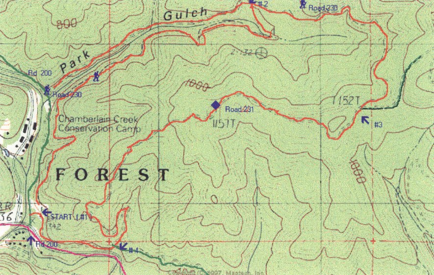 |
| trail: | Part single track and part climb of old logging road . Loop. |
| difficulty: | Moderate. |
| length: | 5.5 miles round trip |
| elevation: | Gradual climb from 400 feet up to 1200 feet and back down to 400. |
| features: | 1200 ft. peak at halfway mark. First section is lovely single track trail following a creek and surrounded by wild flowers in the spring. Hiker Kim writes, "Road 200 runs along the Chamberlain Creek Conservation Camp (which is a California Department of Corrections Prison camp), one is at risk for some interesting encounters along the Park Gulch Trail and the Chamberlain Creek Trail. I was hiking alone (thankfully with my dog!) when I encountered a fellow scrambling up the embankment in orange CDC pants and a white t-shirt. Thankfully he went on his mission without approaching me [but] I must say I would avoid walking along Road 200 if one is hiking alone." |
| directions: | Take Highway 20 to Mile 17.3 and turn north onto road 200. Within 200 feet you will see a parking area (Start #1 on map ) on the right. To the left, looking north, is the start of the trail that is 1.8 miles to a logging road (#2). Turn right on the logging road (Road 230) and follow this until you come to a fork (#3). Take the right fork (Road 231) until you come to another fork, close to Highway 20 (#4). Turn right and follow this until you return to the parking lot. Total mileage is 5.5 miles. |
Trails Map

This page is sponsored by
Campaign to Restore Jackson State Redwood Forest
|
|
|||
| site designed and posted by the Caspar Institute this site generated with 100% recycled electrons! send website feedback to the MendoWalks webster | |||